
Excited to start again with GR11 in Navarra, Spain and Camino del Norte vibes | Day 10 Ochagavia, Sierra de Abodi, Hiriberri
After having an extreme heat wave in the mountains for a week or so in Catalonia province we have decided to move to a different region Navarra, village Ochagavia and start our GR11 trail again there hoping that the weather would be cooler. Also we liked the idea to start the GR trail in Navarra because that way we’ll be able to walk until the ocean coast and finish the route there. As we have been missing the ocean quite a lot since the time of our last Camino. To our calculation, it should have taken us 9 or 10 days to get to the coast.
The plan for that day was to do 15kms from the village Ochagavia getting up 600 meters to 1300m level. We were going to have less elevation changes than when we were more at the northern side of the Pyrenees and we hoped that it would help us to make it even in the hot weather if this would be the case. As we supposed we’d have less challenging trail and have more shade than in the high mountain parts that we hiked before. But of course we didn’t know for sure how it would all go and were ready for some challenges as always.
So that day in Ochagavia we started a bit late at 10am as we stayed in the campground and in that case, we tend to sleep in and overall be more relaxed.
The campground Osate we stayed in was located very close to the village and the trail itself and so we didn’t have to walk many extra kms. Village Ochagavia was a very small peaceful place with the different houses and buildings that you would normally see in Pyrenees made of rocks and with dark roof. There the roofs were more of a red rusty color and the houses were white. For some reason it reminded us of South Tyrol architecture style. The routes were all made of bricks and some were quite uneven.
Then when we crossed the village we faced quite a steep uphill leading to some chapel on top of the hill. From how warm we got this first couple of kms we realized that it is going to be another hot day, and the fact that there was almost no wind certainly didn’t help.


This first part was going through the bushes and was quite narrow at times. It wasn’t too rocky though and had a lot of shade. After 1.5km we came out to the chapel Santuario de Muskilda that was a pretty white little building reminiscent to a monastery to us. It was surrounded by a gate that was closed but probably it was possible to visit and do a tour.


Then the trail turned to the forest and did a bit of an uphill to the top of the hill. It was quite shaded though but still we got very hot as there was little wind. After we crossed a secondary car road and entered the forestry part again, this time the trail went slightly downhill.
Soon we came out to some farm buildings with the working tractor and from there the route followed a nice easy farm road. From that part we started to remember the Camino del Norte because of the easier route and also surprisingly landscapes of the green hills and yellow fields. We noticed quite a lot of fern as well growing on the sides of the path. The views were beautiful from there reminiscent to Ordesa y Monte Perdido National Park with the white abrupt cliffs and green valley below.


We were getting pretty hot at this point that the trail started to go mostly in the sun and also the uphill part began. It was going through bushes and on narrow paths and seemed quite steep. We nearly walked for several kms on it and needed to have a break in the shade. As we were feeling like the sun was striking our heads badly and we had to cool off. So we found a little shade from the pine tree and spend half an hour there.


When we were back on the trail again the wind started to blow and it felt much nicer on the body and very refreshing. Maybe it was because we came to the higher elevation where the wind is always stronger.


So the uphill continued and at that point we started to be concerned about the water sources on the way as we still didn’t meet any. And on higher parts of GR it was never a problem. On the map we saw very few sources and just hoped that in reality there will be more streams. And there we met one, very small and shallow looking but still there was something, so we continued in hope that we’ll meet a few more like that. The availability of water is always very important to us as then we can choose any place we like where to camp and also don’t have to carry much water with us.


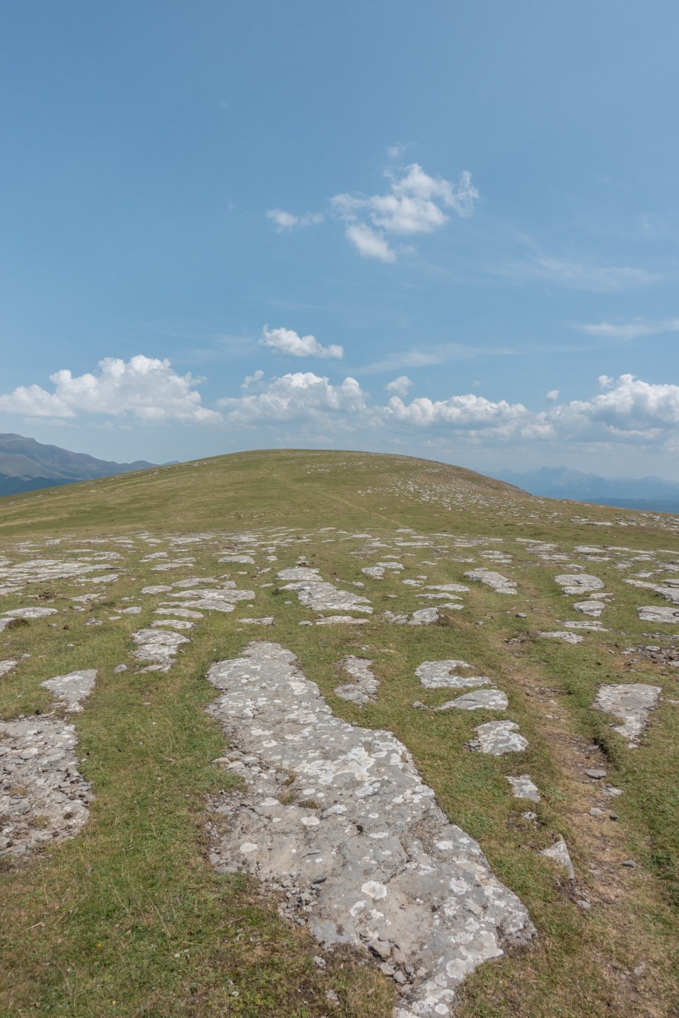
So we kept climbing up and we had to admit that the last part of an uphill was going pretty straightforward. The path was following the hill in a straight way with no zig zaggy parts. And it was pretty challenging to conquer especially in the hot sun. So we had to go real slow because of that. It wasn’t rocky though and overall we enjoyed a lot stepping on the grassy and mossy terrain instead of rocks that we were used to previously on the trail.


We passed by some horses and cows pasturing and saw a small rocky refuge house. The trail wasn’t going too steep at that point but still mostly in the sun. Soon we came out to the soft grassy path still following the gentle uphill. Turning back we started to see the magnificent rocky mountain ridge views and overall the incredible views on all sides. This part again reminded us a lot of the Camino del Norte because of the green hills we passed there and also flora and fauna were similar too. It seemed like you just need to turn to the side and you will see the ocean coast.


We followed the trail always keeping in sight the white and red stakes that were pretty good on all the trail that day so far and we barely had to use our GPS map.
Throughout the whole day we met only around 6 backpackers going in reverse direction from ours but still it was nice to see the fellow hikers.


So we did continue on that panoramic part going up and down quite a bit but with no major changes and enjoying the incredible scenery. We got a pleasant wind from the side too and it felt amazing. The low clouds laying and hugging the ravines and mountain hills were very pretty sight too.


Then we had to do the downhill to the parking spot where we saw quite a bit of cars and thought that maybe it is a pretty popular spot to hike. At that point, we were already pretty hungry and searching for the place to have lunch. As all we saw were the open fields with no shade, we knew we had to stop in the sun.
So we crossed the car road and continued on the gravel route leading a bit uphill again. We had to skip over the farmers gate that we started to meet quite a lot now, it was pretty uncomfortable. Then we saw on the map one of the possible water streams and turned away to check it out. It turned out to be the closed metal door on the ground but there we could hear the sound of water. It could be the source but unfortunately, we couldn’t get to it. So we decided to stop there to lunch right in the sun and spend half an hour there resting and eating.
At that point, it was already 3pm, we were getting close to our potential camp spot that we marked as a desirable distance to make but as there was no water sources in sight we had to keep going.


So the trail went up and down and up and down again. These weren’t major elevation changes but was definitely a specialty of the terrain of this part of the trail. But as the route itself wasn’t challenging it wasn’t tiring neither.
We saw that it was mostly the cow pastures from the amount of cow pies we met and also the bells we heard from a distance. Anyway it would be quite an unusual place to camp for us even if there was a water source as we preferred more foresty areas to the completely open ones like that we were passing.


Then the trail turned again to the uphill and entered the forest and the shade. The low foggy like clouds were passing very low through this area and almost touching our heads. It was one of challenging parts for us because we were already quite exhausted from the heat and overall in the muscles and back, even though it was going in the shade and with the wind it was hard to do. Probably because the terrain itself was rockier and more uneven and unstable we had to go slower and watch our step. That’s why these last 3.5kms till the water fountain seemed the hardest. In addition, we were running low on water supply and were very thirsty.


Then we had to do the steep 250m 1.5km downhill part, last stretch to the water source. We really hoped it existed, otherwise it would have been a major disappointment.
When we finally heard the water sound and saw the stream, it was the pure joy. We could wash our faces and drink as much as we please. Also fortunately, it seemed a true fountain with clear and very cold water and there was no need for us to filter it.
So we filled all our bottles and containers in and headed to the camp spot. Luckily, we saw potentially flat spot right at the side of GR trail and 200m away going back from a source. Normally we wouldn’t have preferred it to be visible from the trail but as it was already pretty late we had to go with it.
So we did our shower set up first with the flysheet of the tent, heating our water on a gas stove a bit and using our water container to shower. We didn’t do it every day but because there was a cold wind we had to set it up. It felt incredibly nice to wash off all that sweat from the day and just feel clean. Then we set up the tent on a spot that seemed more flat and suitable to us. After we cooked our rice with dehydrated tomatoes and mushrooms and a bread and ate it with a huge appetite. We were tired but overall happy with the day and just were thinking about planning our water supply better and had to check our map and plans for the day again because of that. We went to sleep listening to the cows bells and hoping that nobody would disturb our sleep..
Here is the link to Google map to follow the hike:


You May Also Like

Impossible Descent on GR11 and Breathtaking Views of Comapedrosa Natural Park | Day 5 – Crossing from Andorra to Spain

First Challenging Day of Hiking and Meeting the Sunset on GR11 in Pyrenees, Spain | Day 2 Refugi Malniu – Cabana dels Espravers
